Simple greenhouses may be the way to grow food on Mars

Mars with all its glory has become a part of our routine life it seems. Daily one or the other news relating to the Mars mission or the planet itself, keeps appearing in newspapers or popping up on news channels. The latest announcement made by NASA this Monday about uncovering the strongest evidence for flowing water on Mars has again everyone talking about the possibility of finding and sustaining life on the red planet.

marsfarm

If there is evidence of water on the Mars then everyone knows that a basic necessity for sustaining life is already there. Not only this, John Grunsfeld also assumes that this news leads to the idea that future astronauts will be able to grow living sustainable crops on the Mars.

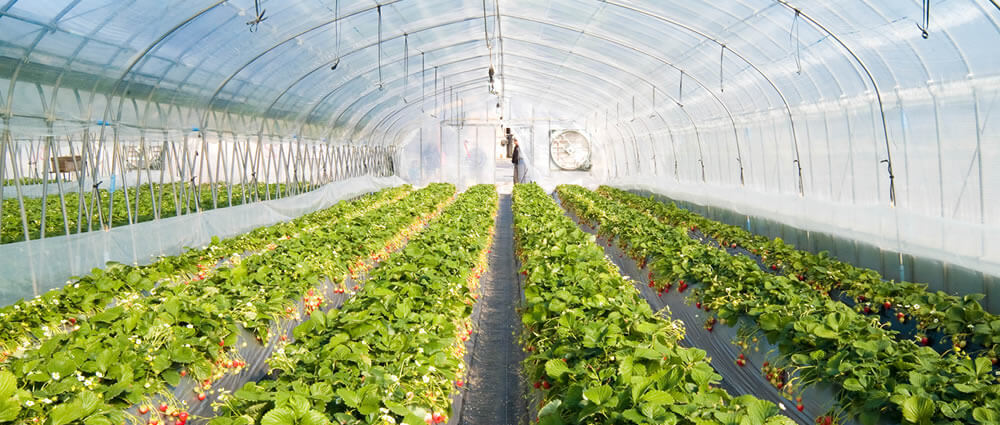
When Grunsfeld was asked about the sustainability of Earth crops on Mars he pointed out that the red planet’s relative altitude which is almost three times the height of Mount Everest would completely dry out or remove moisture from any plant grown on the planet’s surface. He decided to stick with his earlier statement of growing food on Mars by explaining that astronauts going to Mars will have the ability to construct small, inflatable greenhouses that would be highly pressurized.

With the help of the planet’s apparent water, as well as the abundance of carbon dioxide for plant’s to create oxygen with, maintaining living crops on Mars won’t be a far-fetched idea. In Grunsfeld’s words: ““You’d have a challenge growing plants on the surface of Mars, even with some extreme genetic engineering, but certainly you could build inflatable or small greenhouses with high pressure, and if there’s a lot of water on Mars you could then use that water to grow plants inside the greenhouse.”
deployablegreenhouse

Though there is still a lot to be done as far as research and development for Mars Mission is concerned, ideas and findings like these might shift the date of astronauts landing on Mars, a little earlier than expected.

[adinserter block=”7″]

Author: Technology Blog

Drones to help conserve forests

Deforestation has always been a big concern for environmentalists and people fighting to reduce the carbon footprint. If anything that severely affects the environment (after pollution) it is deforestation. So there are many forest regeneration projects running across the tropics to save forests. But these forest regeneration projects become too difficult because of the large land area covered by the rainforests. Also, the traditional labour-based method of monitoring and data gathering is quite taxing in terms of time and money.

Sumatra-drone-throw

This is where our humble four-armed drone comes into picture. Drones as of now have proved to be of great significance in wildlife conservation and illegal fishing patrols. Now they may soon lend a helping hand in forest conservation. As part of a study by the University of Maryland and University of California, Santa Cruz, together with the Organization for Tropical Studies in Costa Rica, drone-based monitoring was tested recently.

For this study, the researchers adopted a remote-sensing technique called Ecosynth which generates 3D “point cloud” models of vegetation from computer vision software, paired with aerial photos from 10 megapixel cameras fitted to the drones. Using these cameras, the drone captured thousands of overlapping images across 13 forest restoration sites each measuring one hectare and spread across a 100 sq km mountainous area of southern Costa Rica.

After all these images were clicked and compiled, the researchers then moved on to the next part of the study, which was the comparison between the two methods: one using drone and the other using traditional human monitoring. The results were compared on various parameters like: the height, bumpiness, roughness, and openness of the canopy. They also studied as to how well Ecosynth measurements predicted the abundance of fruit-eating birds, which are important to the process of forest regeneration.

The results showed that mostly Ecosynth metrics were comparable to field based measurements but in case of lower and rougher canopies, the accuracy was more hit-and-miss. The researchers want to rectify this problem so that drones can make themselves useful in all the canopy situations in the long run.

(ALL INTERNAL & LIMITED EXTERNAL RIGHTS) May 2014. Jordan Mitchell pilots a quad copter drone over a Red Mangrove forest. The drone carries a GoPro 3+ camera used to survey the bottom topography. mitchjet@gmail.com Photo credit: © Tim Calver for The Nature Conservancy

It is to be noted that the existing alternative to manual monitoring, LiDAR (Light Detection and Ranging), costs at least US$20,000 a flight. So if drones can be modified as the way researchers want them to, it could be a great victory for tropical forest recovery and conservation as a US$1,500 drone would be able to reach and access many difficult to reach rainforests. This will surely cut down the time as well as cost involved in monitoring these forests. A firm step towards the future indeed!

[adinserter block=”7″]

Author: Technology Blog

Verified by ExactMetrics